

Run an analysis of a selected shoreline to predict its changes over a period of time. Input local geographic and environmental parameters, customize them according to the latest feedback, etc. Apply endpoint rate, simple linear regression, weighted linear regression, and least median of squares methods for calculation.
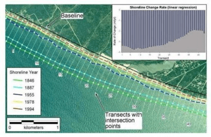
The Digital Shoreline Analysis System (DSAS) is an application that enables a user to calculate shoreline rate-of-change statistics from multiple historic shoreline positions. DSAS computes shoreline rates of change using four different methods: endpoint rate, simple linear regression, weighted linear regression, and least median of squares.




Comments